
Solar Radiation Modelling in Guernsey
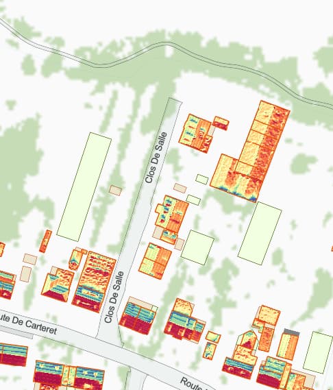
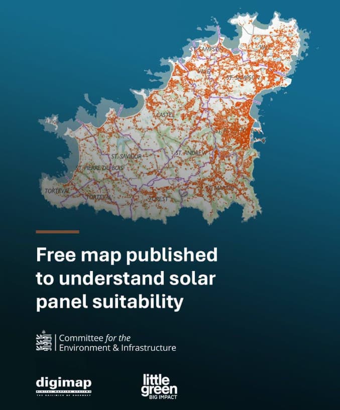
Digimap worked with the States of Guernsey to produce a free map to help householders decide whether their property is suited to rooftop solar panels.
The publicly available solar potential map for Guernsey was generated using the Raster Solar Radiation tool in ArcGIS Pro Spatial Analyst. It calculates the amount of incoming solar energy (insolation) received at each cell in a raster surface, using a Digital Surface Model (DSM) or terrain model. It is designed for modelling solar exposure across landscapes, rooftops, or other surfaces.
Estimating the insolation on a surface has applications in the natural sciences, agriculture and, as in this case, planning solar power installations.
For each raster cell, the tool calculates:
- Direct solar radiation arising from an unobstructed view of the sun
- Diffuse solar radiation arising from scattering of sunlight
As the licensed-reseller of the States of Guernsey mapping data, Digimap were able to use a DSM derived from photogrammetry of the island which contains buildings, trees, and other structures. These were included in the shadow calculations, making the output suitable for urban solar assessments.
Why this approach was used
For a whole-island assessment, the Raster Solar Radiation method offers significant advantages over simpler analytical techniques.
Realistic representation of roof conditions
Some solar maps rely on broad regional averages of sunshine hours or meteorological data alone. These methods can indicate general solar resource availability but cannot distinguish between neighbouring properties with very different roof characteristics.
Similarly, many solar suitability studies use only roof aspect (direction) and slope to estimate potential solar gain. These often ignore the impact of surrounding terrain, neighbouring buildings, vegetation, and other obstructions.
The ArcGIS model explicitly incorporates:
- Roof orientation and pitch
- Elevation
- Topographic shading
- Shadows cast by surrounding features
- Seasonal changes in sun angle
- Atmospheric effects
As a result, it produces a more realistic estimate of the solar resource available at each rooftop location. By using a high-resolution surface model, the ArcGIS approach can reveal significant local variations in solar potential, helping users identify which roofs are likely to perform better than others.
Consistent island-wide assessment
Using a single geoprocessing workflow enables every rooftop to be assessed using the same methodology, assumptions, and environmental parameters. This creates a comparable dataset that supports:
- Public information services
- Strategic energy planning
- Indentification of high-potential areas
- Evidence-based policy development
The result is a standardised evidence base across the entire island rather than a series of building-by-building assessments.
Repeatable
Alternative methods often involve manual site surveys or detailed engineering assessments for each property. While these may provide greater accuracy at an individual building level, they are impractical for analysing thousands of rooftops across an entire island.
Using GIS to conduct the analysis allows:
- Rapid processing of large geographic areas
- Repeatable updates when new elevation or building data becomes available
- Consistent methodology across future assessments
Limitations
Although this methodology is highly effective for strategic and public-information purposes, the results should be regarded as an indicative assessment rather than a replacement for a professional solar design survey.
The model cannot directly account for factors such as structural suitability of the roof, electrical connection capacity, future vegetation growth and engineering details.
Consequently, while the map provides an excellent first-pass assessment of solar resource availability, individual installations would still require site-specific evaluation before deployment.
References
Summary
The use of the ArcGIS Pro Raster Solar Radiation tool is a robust, industry-recognised approach. Compared with simpler methods based solely on roof orientation, sunshine averages, or manual estimation, it provides a more realistic representation of available solar energy by modelling shadows, terrain, atmospheric conditions, and roof geometry consistently across all of Guernsey. This makes it particularly well suited to supporting public engagement, renewable energy planning, and the identification of opportunities for rooftop solar.
A catalyst for change
Agreed by the States in 2023, one of the goals of the Electricity Strategy is to increase the amount of energy generated from local renewable sources. At the end of 2025, Guernsey had around 4MW of photovoltaic generation capacity. However, the target is 10MW by the end of 2028, with the intent that this will continue to increase. The map will help householders understand whether they can benefit from installing solar panels.
Deputy Adrian Gabriel, President of the Committee for the Environment & Infrastructure, said:
“As we get about 30-35% more sunshine than the UK average, this free tool makes us well placed to understand how we can better take advantage of the energy we can harness from the sun.“
“While we’d always encourage islanders to contact trusted professionals before embarking on installing solar panels, this is a really helpful tool to get an initial idea on whether the potential for solar is there for householders. It’s clear that there is a significant opportunity in our island, and this map might just be the catalyst to take Guernsey’s solar generation to the next level.”
States of Guernsey media release: https://gov.gg/free-map-published-to-understand-solar-suitability
Rooftop solar panel suitability map
Contact us to find out more.