Digimap was founded as the commercial reseller of mapping data, initially on behalf of the government of Guernsey, and now for all of the Channel Islands. We now develop bespoke software for public and private sector applications, provide specialist data sets and offer our customers a flexible approach to land surveying.
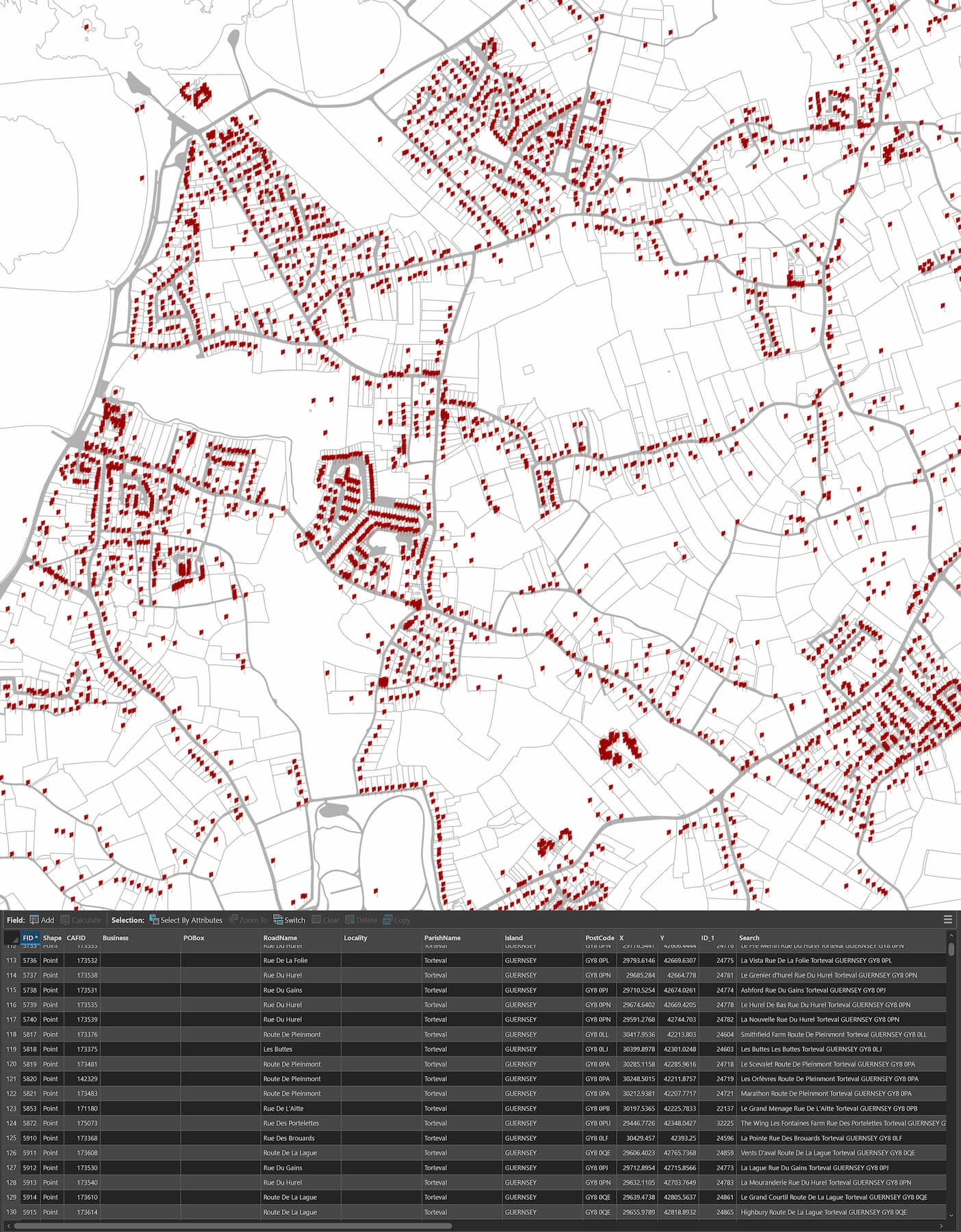
Mapping & GIS
From simple map prints to GIS solutions for national infrastructure.

Software Solutions
Bespoke software to fulfil complex tasks in goverment and industry.
Data Supply
Specialist datasets distributed through online products, API integration and bespoke software.
Data Capture
Sales, hire, support and Channel Island agency for Leica Geosystems instruments.

Third Sector
We provide training, consultancy and solutions to charities.
Our partnerships give our customers access to industry-leading suppliers of GIS and surveying solutions.

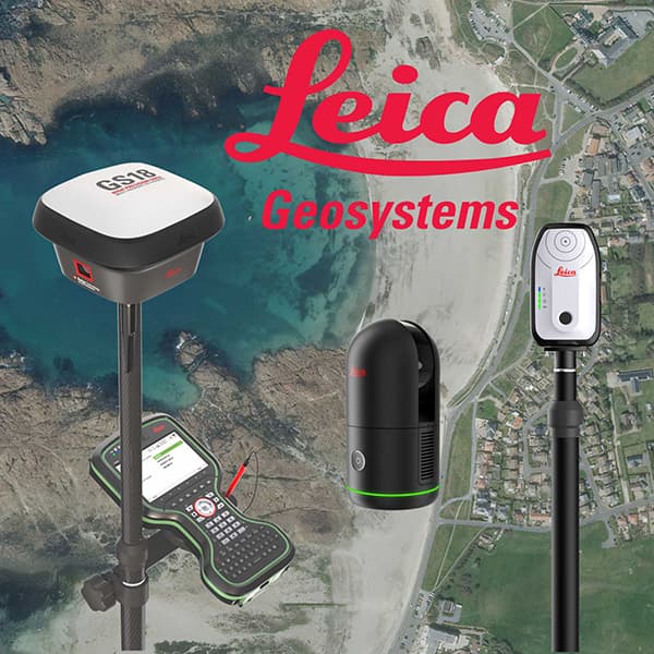
Digimap are the agent for Leica Geosystems products in the Channel Islands.
Please see Leica Geosystems’ UK page for detailed product information. Our hardware page details our hire and sales services.